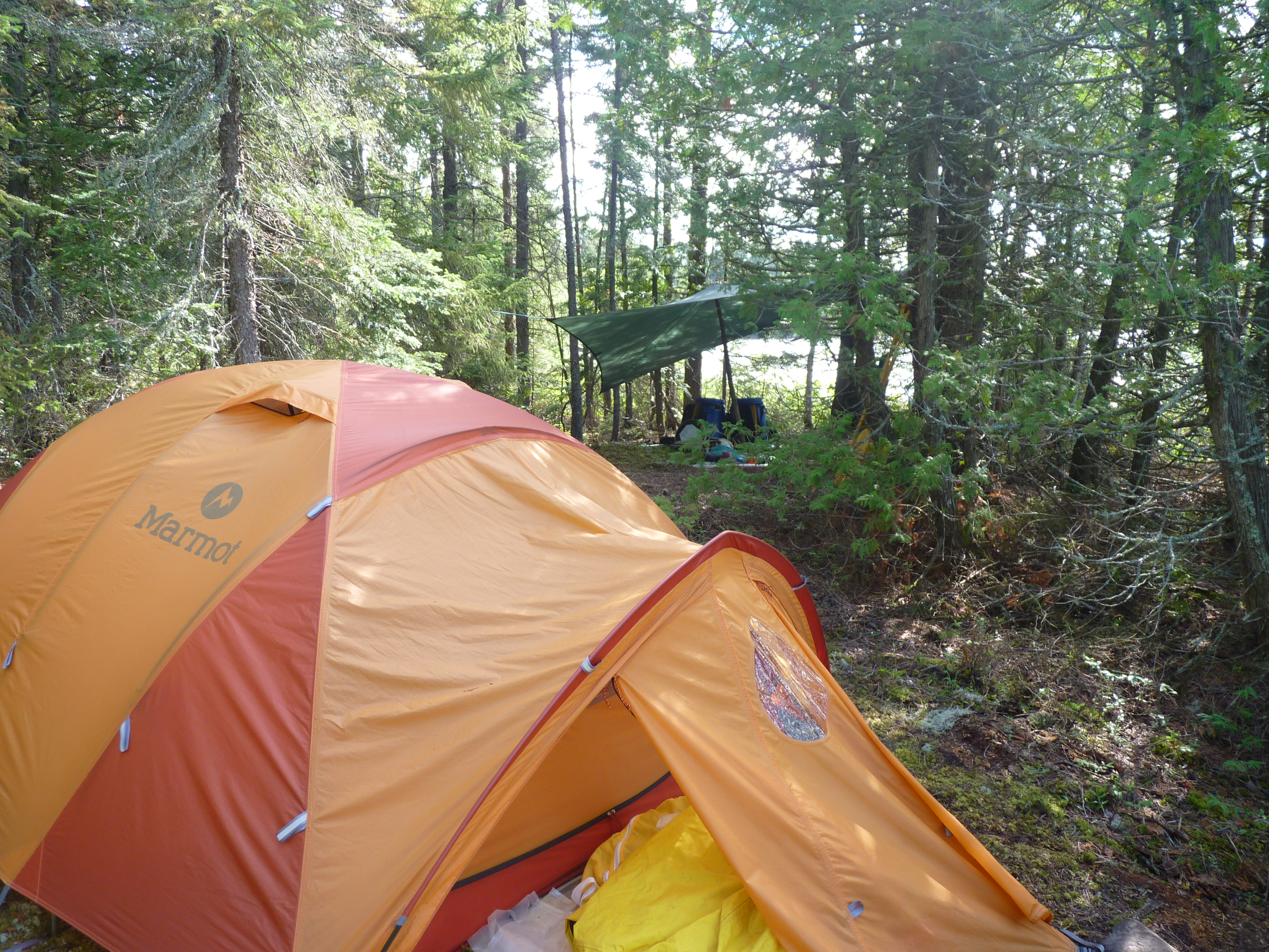
What we've accomplished
2008
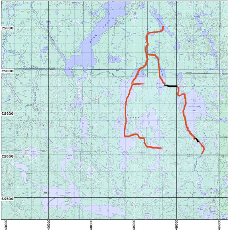
After our discussion in 2008 we retraced our steps to the outlet of Rush Lake and cleared the portages from Rush Lake down to the Rush River and to the Woman River.
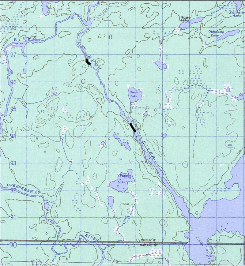
To see the map of the Rush River portages ...
Rush River portages
2008 also saw us mark and open up the portages from Rush Lake to Rice Lake just enough so that we could get through ... leaving the final touches for another time ... remember, this is our vacation time so we don't want to spend it all finding and clearing portages.
As it turned out 2008 was a good year for this initial effort. Since the water was high that year it forced us to look for portages where in the past we'd waded and dragged the canoe up sections of the river.
We succeeded in locating all the old portages that I'd remembered from 1978 ... all the trail markings were gone but there was still evidence of a trail if we looked closely at the ground.
We explored each portage to its end ... installed flagging tape ... and cleared just enough so that we could get through.
A trip up the Rice River that now takes about 5 hours took us 12 hours that day ... and because of all the high water the bugs were bad that year ... we were a mess by the time we got to Rice Lake.
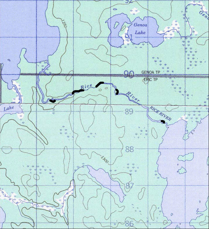
To see the map of the Rice River portages ...
Rice River portages
We also explored the south end of Rice Lake and located an ATV trail which led west to a road ... by following that road to the south and then exploring a branch to the east we were able to overlook Little Rice Lake ... the total road distance from Rice to the overlook was about 2 km.
We did walk down to the shore of Little Rice but the area had been logged and it was a tangle of downed trees and raspberry canes ... there was no visible path that could be used as a portage.
To see the road setup ....
Rice Lake South roads
Notice that the road on the map is in red ... there are signs at the south end of the road where it leaves the Sultan Road warning that the road may not be used to access Rice Lake ... therefore if you want to get to Rice Lake you will have to approach from either Rush Lake or Little Rice Lake.
2009
We returned and completed the marking and clearing of the portages from Rush to Rice Lakes.
There are five portages along the Rice river from Rush Lake to Rice Lake.
The first is on the right just after a small swift that can be paddled up in all but very high water ... it's about 250 meters ... the landing is rockey but the put-in is grassy.
The remaining portages are all on the left ...
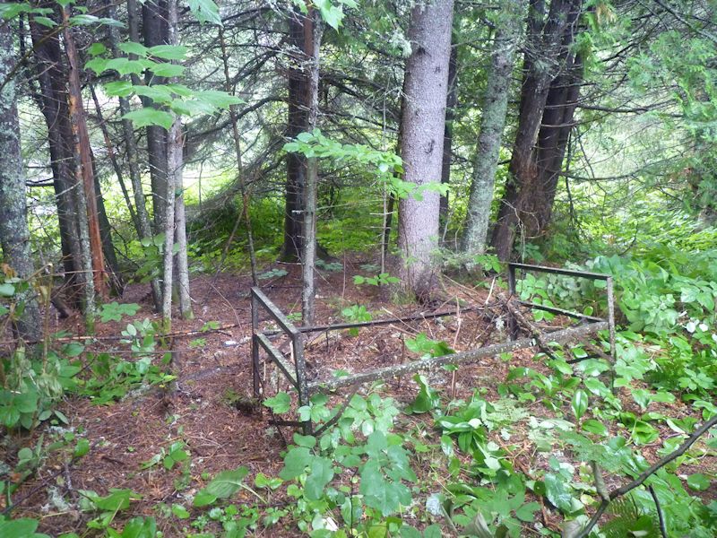
The next is a short 75 meter carry around a small drop ... we call this the bed frame portage because of the presence of an old iron bed frame along the path ...
To see the bed frame...
We'd love to know how this got here ... who brought it ... and when. It must have been part of a trappers line and served as a layover point. In the late 70's there was a house on Arbutus Lake and a cabin on Little Rice. The house is gone and the cabin has collapsed. These, and evidence of other old campsites in the area, must have been the domain of a trapper.
The third portage is the longest of the series at about 600 meters.
The fourth, which starts with a small uphill section, is about 250 meters in length.
The final carry is around a ledge and encompasses 100 meters.
Just upstream from here is the outflow of Rice Lake which can be paddled up in all but very high water levels.
In the late 80's we would wade and drag the canoe up and down the first, third and fourth obstacles. The river was kept open by the trapper. At this point the only the fourth can be waded due to trees across the river.
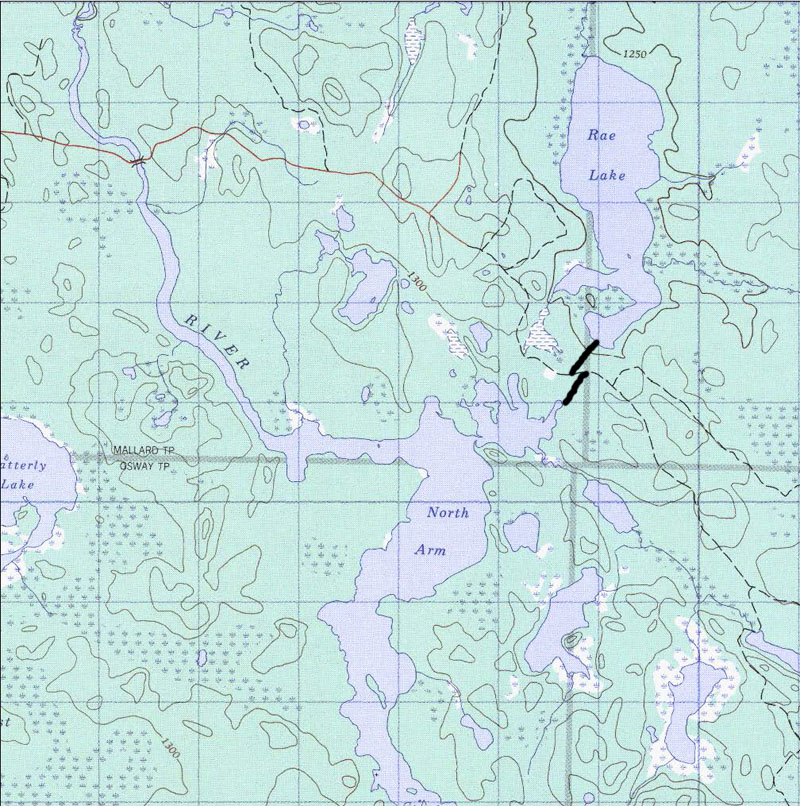
With the Rice river portages completed we moved over to Opeepeesway Lake to begin the search for the portage to Rae Lake.
With the road to Rush Lake closed in to all but ATV traffic we need an easier path to Rush Lake if we're to visit there in the future ... this year we drove up the Rush Lake road as far as a trappers cabin on Mallard Lake to get access but that road is also closing in and I would not recommend it to anyone without a four wheel drive vehicle .... and plan to get your vehicle scratched up from the overhanging brush.
It didn't take us long to find the beginning of the old portage and we followed it for about 200 meters before it led into a big blowdown area ... but at least we know its here so we'll come back next year to clear it.
2010
Boy did we ever work this year.
We arrived at the road to the Opeepeesway River bridge to find a notice that the bridge was to be removed and rebuilt so we were not to cross the bridge.
This put a bit of a crimp in our plans because we were planning to try to find the portage from the road that crosses the bridge and then passes between Opeepeesway and Rae Lakes.
We'd seen the portage many years ago ... probably around the mid 80's ... so we thought that we could find it from the road ... but it was not to be.
We arrived at the bridge to find some people camped there and they told us that the repair crew had been there and informed them that they'd be back today to start the construction.
Sure enough ... as we were almost unloaded the crew arrived.
The construction project would begin tomorrow and would take about a month to complete. When asked if there were plans to begin logging in the area again they had no inkling ... but why would the bridge get rebuilt unless it was to be used for the passage of logging trucks?
If the road does get rebuilt I'm betting that signs like the ones at the road to Rice Lake go up ... after all, the same fly-in service owns the camps on both Rice and Rush lakes ... so now it's more important than ever to get that portage from Opeepeesway to Rae completed.
We setup camp on Opeepeesway Lake near the portage we found last year but the water was really low in 2010 so we couldn't paddle up to the portage ... we had to pull out about 150 meters from the actual portage and bushwack our way over to the start.
We followed the portage for the first 250 meters or so before we lost it in a blowdown.
Taking a bearing and marking our trail with flaging tape we worked our way out to the road ... now to find the continuation to Rae Lake.
A few circles through the bush on the north side of the road produced no results so we took a bearing to Rae Lake to see if we could find it there
Arriving on Rae Lake we traversed the south shore and it didn't take us long to find the trail ... so up through the bush we went marking our way.
A little searching and our markers to the Opeepeesway trail were visible ... by the time we got to the south end of the trail we'd used up a whole day ... now we needed to straighten the trail a bit and begin clearing it.
The Rae Lake side was very obvious so we decided to clear it first ... it also gave us a chance to walk the Opeepeesway side a few times to see if we needed to make any modifications.
It took us a day to clear the Rae Lake portion but we had to leave four or five fallen trees that were over a foot in diameter because our handsaw was not big enough to tackle them ... so if any of you want to take a chainsaw and finish clearing the trail it would be easy to get a 14 foot boat down to Rae Lake ... and I don't know when it got fished last.
It took us three more days to finish the Opeepeesway side of the trail by the time we adjusted the trail and cleared small sections at a time ... but we did finish it.
By the way, we did brush out a bit of a trail from our landing spot to the portage in case anyone arrives in low water conditions.
To see the portages ...
The trails are well marked at the road so if you approach from there you should not be able to miss the flagging tape.
The distance from the bridge to the Opeepeesway to Rae portage is 6km or 3.7 miles.
We'll return in 2011 to see if we can find our way through Little Rice Lake to Rice Lake.
We've heard that the traditional portage is gone but that there is a snowmobile trail that we might be able to use.
2011
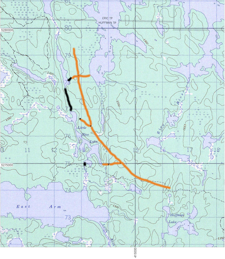
We returned in August to begin the quest for the portage from Little Rice to Rice Lake.
We first drove up the New Arbutus Road to see what conditions were like there.
Arriving at the bridge that spans the outlet of Stony Lake we noticed that the road beyond there was closing in rapidly. However, we heard that someone had been working on the old portage from Stony to Arbutus so we wanted to check it out.
After some searching we did find some flagging tape and followed it to what might be a put in but the trail needs a lot of work before it is ready for prime time.
We'd hoped to be able to start here but after some looking around and a short discussion we decided to forego the clearing of this trail and instead start at the bridge over the Opeepeesway River.
The new bridge is a thing to behold ... it's well done and should last for the next 50 years.
Crossing the bridge we continued east on the road to check on our trail markers ... and sure enough they're still there.
Putting in at the bridge we paddled out onto Opeepeesway Lake and camped for the night.
The next day we paddled to the far eastern end of Opeepeesway Lake where there's a nice campsite with a great sand beach. Swimming here is nice as the sand extends out into the lake. This is the only place on the east end of the lake that is not rocky and slippery.
We next took an exploratory trip up to Little Rice and paddled to the northeast arm to look for the portage where I remembered it from 1978. In two hours of thrashing around in the bush we found the snowmobile trail that leads north to an unnamed lake and the old trappers trail with the same destination. We left the exploration of these trails for another day and returned to our campsite.
There's a beaver dam and a short portage ... 60 meters ... to get to Little Rice Lake.
Armed with the knowledge of the snowmobile trail we moved our base to Little Rice. There's only a couple of places to camp here. One at the middle of the lake might hold two tents.
I really wanted to find the old portage so we spent another couple of hours and actually found a few blazes but the trail soon petered out so we walked the snowmobile trail north to the unnamed lake. The trail is in pretty good shape but it's constructed through the low ground leaving it boggy and muddy in sections. But hey ... we're halfway there.
Before carrying all our stuff over to the unnamed lake we decided to go back down Little Rice to the southeast bay where we saw a boat pulled up into the bush. we figured that there must be a trail up to the logging road and from there we could walk north to see if we could find the missing link to Rice Lake.
We took our GPS so that we could mark some waypoints and we took some flagging tape to mark the intersections we were sure we'd find.
It took about three hours but we walked up to the ATV trail into Rice Lake and explored the side roads ... and guess what? ... We found the other end of the snowmobile trail!!! It was right where it should have been.
Following the trail down to the unnamed lake, we could see that we only needed to paddle about 500 meters to connect the two portages.
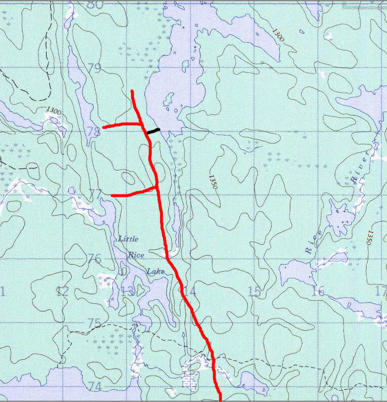
To see Little Rice trails and roads ...
So here's the skinny .... The portages from Little Rice to Rice total about 2100 meters. The first is about 1000 meters and mostly boggy going but it's flat and we were able to avoid getting too muddy. The second section ... from the unnamed lake to Rice Lake ... starts up through rocky going and meets a road. From there down to Rice Lake is over an ATV trail. The Rice Lake end is very swampy and chewed up so we'd advise carrying a light load first so that you can plan your route through this quagmire.
If you want to try to use a cart the trail from the southeast end of Little Rice is a possibility. As is the road that comes within about 200 meters of the lake at its north end ... but this will involve bushwacking up the hill to the road. I'd try walking either of these a little bit to be sure that they're open.
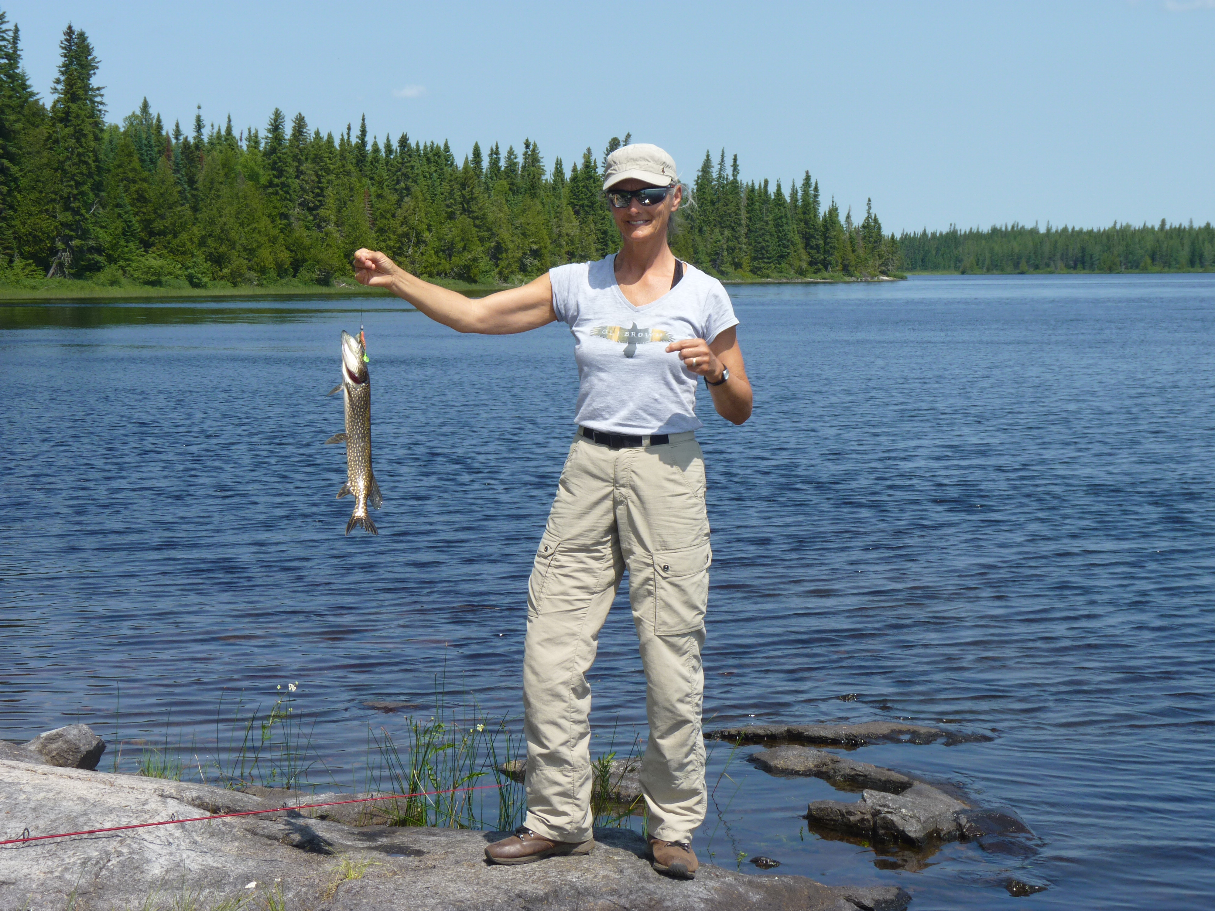
Of course we went over to Rice Lake. There are still some possible campsites on the islands at the south end of the lake but we prefer to be around the narrows and there's a spot there.
and the fishin's still good ...
Picking a nice sunny day with hardly any breeze, we took a day trip up to Northpoint Lake.
There's an old fly-in camp there that doesn't get used anymore ... we met people who were staying there in about 2004 and at that time they reported that the pike fishing in Northpoint was really good.
Returning to Little Rice we decided to have one more look for the old portage ... and lo and behold we found it!!
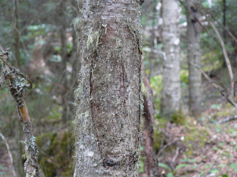
a pretty obscure blaze ...
We followed the old blazes for about 300 meters before we took a look at each other and said ... "Even if we mark this trail who will ever come along and clear it?"
We'd be happy to go back and mark the trail if anyone will volunteer to clear it. Near Little Rice will require a bit of cutting but the trail passes through mature forest for the next 200 meters ... only about 1000 meters to go ... and that involves crossing the road since the old landing on Rice Lake was about 200 meters south of the current ATV trail.
Anybody game?
I also went to look for the old trappers cabin that I remembered from 1978.
In 1978 this was standing and active ...
I think we'll come back in 2012 and do the complete circle.
We'll probably start at either the bridge over the Opeepeesway River or at Arbutus Lake and travel up through Rae Lake first. Our reasoning is that if water levels are low we'd rather find out at the beginning that the passage from Rae to Mallard is almost impassable.
2013 - July
So much for the promise to return in 2012
Instead we spent our time in Quebec canoeing on Kipawa Lake ... a beautiful but busier place ... but now we're back.
We came back in July and did the loop from the bridge over the Opeepeesway river up through Rae, Mallard and Marion to Rush then up the Rice River to Rice Lake ... up to Northpoint Lake and back to Rice ... south on Rice and over to Little Rice ... back to the east end of Opeepeesway ... then up to the north end of Opeepeesway to end our trip.
We started the trip on July 13 ... during a heat wave ... and the bugs were really cooking.
After driving through the night and having breakfast at the Watershed we put in at the Bridge over the outlet of Opeepeesway Lake and paddled to the mouth of the northeast bay before camping for the night.
We'd had a lot of rain this year so the water levels were quite high. High enough to paddle right up to the portage leaving Opeepeesway Lake for Rae Lake the next morning.
The portage was easy enough to follow but it looks as if it has not been used.
We cleared away some brush on either side of the road, did some minor clearing along the trail and re-tagged the route before completing the carry to Rae Lake.
By the time we got to Rae Lake I looked like Pigpen from the cartoon section with the cloud of bugs around me. I was wearing gloves but the mosquitos were biting right through the backs of them to say nothing of the shirt that was sweat plastered to my torso ... the temperature was 29 Celsius.
The breeze was from the south as we traveled up through Rae Lake to Mallard and Marion Lakes and finally out to Rush Lake where we camped on that first night.
The five portages from Rush to Rice were easy to find and thankfully only required some minor clearing and re-tagging since it was still hot and the bugs were out in full force.
The portages look to have not been used very much if at all.
We ventured up to Northpoint Lake and stayed there for a night but the bugs were bad here so we left the next morning and returned to Rice Lake.
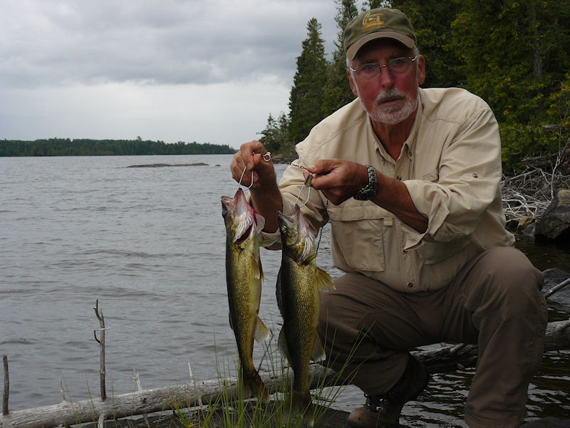
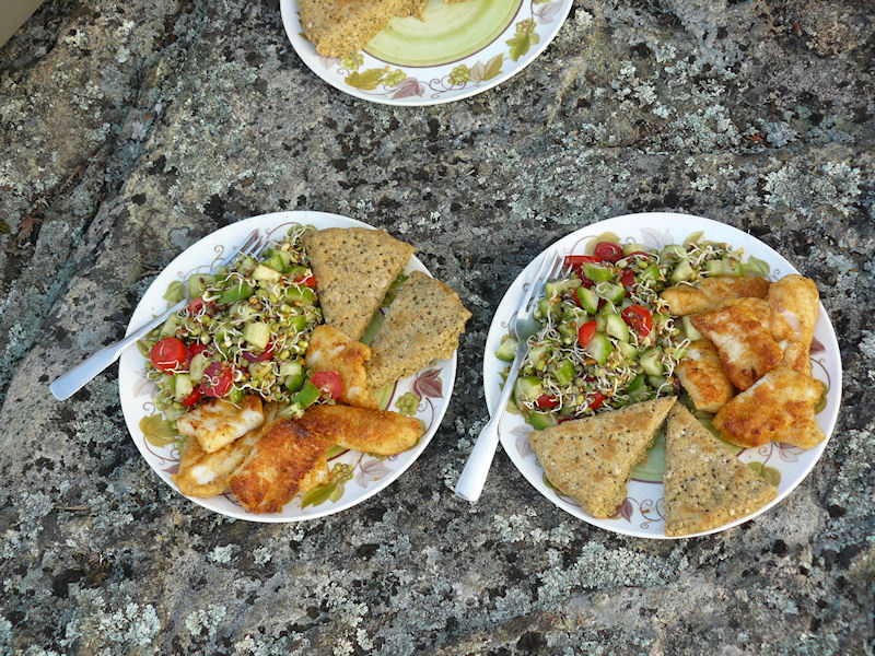
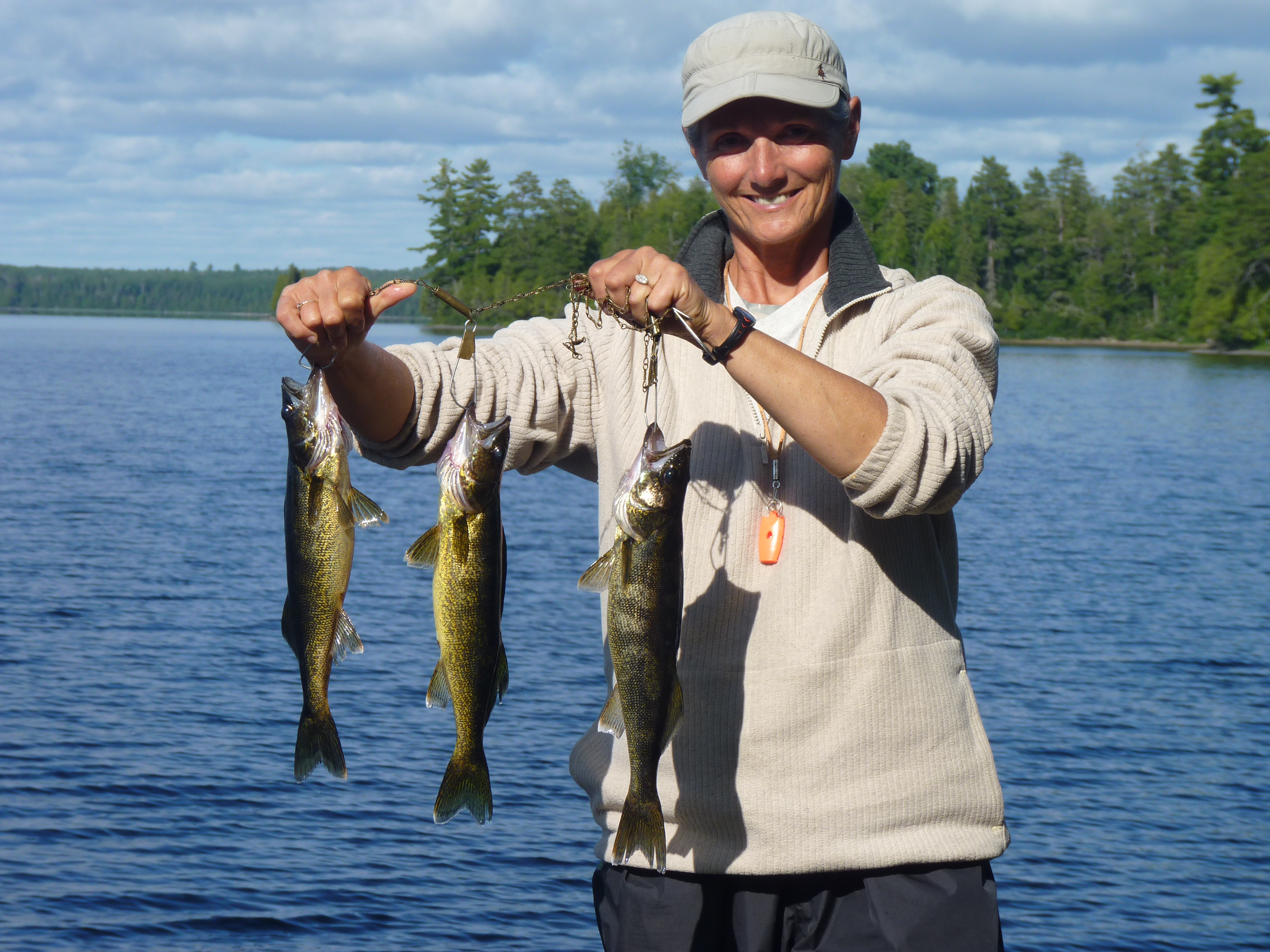
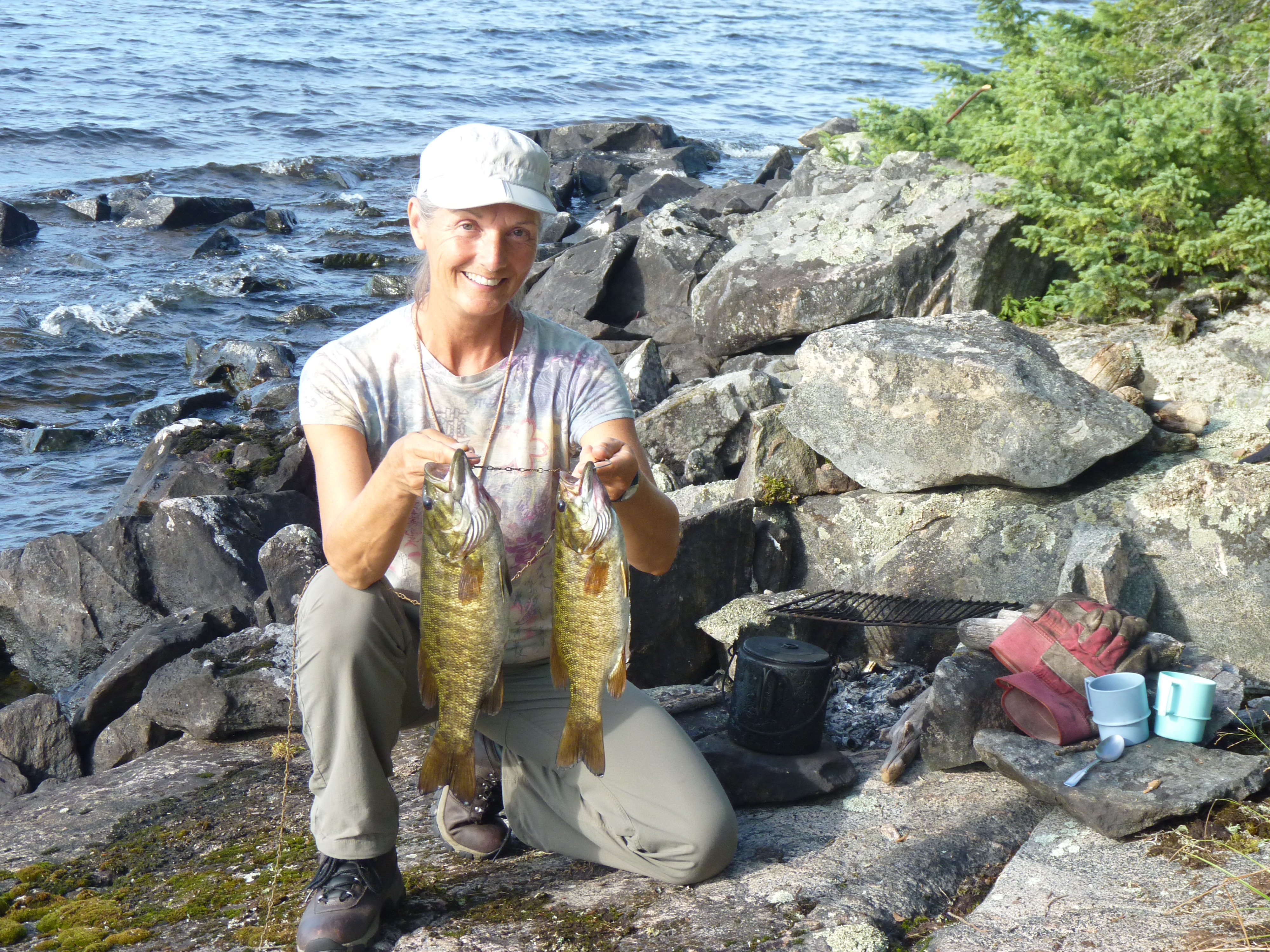
Our stay on Rice Lake was punctuated with a lot of swimming to get cooled off and a fair amount of fishing ... for evidence of our luck ...
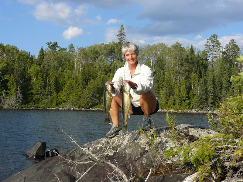
Walleye of 16 and 20 inches ...
These we had for dinner with a sprout salad and pesto bisquits ...
Rice Lake Gourmet Dinner ...
If you haven't tried sprouting on longer trips it's a fairly easy process only requiring some muslin bags, some sprouting seeds and some potable water. Check with your local health food store for the seeds. The process tales us about four days from the initial soaking of the beans and seeds until they're ready for consumption as sprouts.
We left through the south end of Rice and did the three portages necessary to get out to the east end of Opeepeesway Lake.
The portage from the unnamed pond to Little Rice Lake was wet and a little tough going in places but these trails are well used by snowmobilers so they are pretty clear.
We lucked out and got a really nice day to paddle up to the north end of Opeepeesway Lake. Almost no wind and a cooler day.
A rest and clean up day and we're ready to rejoin civilization
We're planning to go back on August 10 through 24 to put in a little more time on one of our favourite haunts ... and hopefully get in a little more fishing ... and a little fewer bug bites.
If you've never visited this area it's pretty easy to get around ... and the walleye fishing is the best we've encountered in mid-Ontario.
So come on folks ... the area needs to be traveled to keep the portages open ... and I'm not getting any younger.
By the way, we've never encountered another canoe party in all our years of canoeing this area.
2013 - August
As promised we returned from Aug 10 to 24.
This time we started at Mallard Lake ... you can drive to Mallard if you've got a four wheel drive and don't mind a few scratches.
Access to Mallard Lake ...
Launching on Mallard at about 10am and were on Rice by 5pm ... the portages on the Rice river were clear and dry.
Spent a few days on Rice before heading up to Northpoint.
As we paddled up the Northpoint River we decided to try to get to Wenakoshi since the water was up this year ... after about an hour of stream work and two small beaver dams we were on Wenakoshi.
Looks like nobody has been here in a few years.
About a third of the way down the west shore we spotted a washed up dock and some old cribbing. Further investigation revealed a clearing and a burned out cabin.
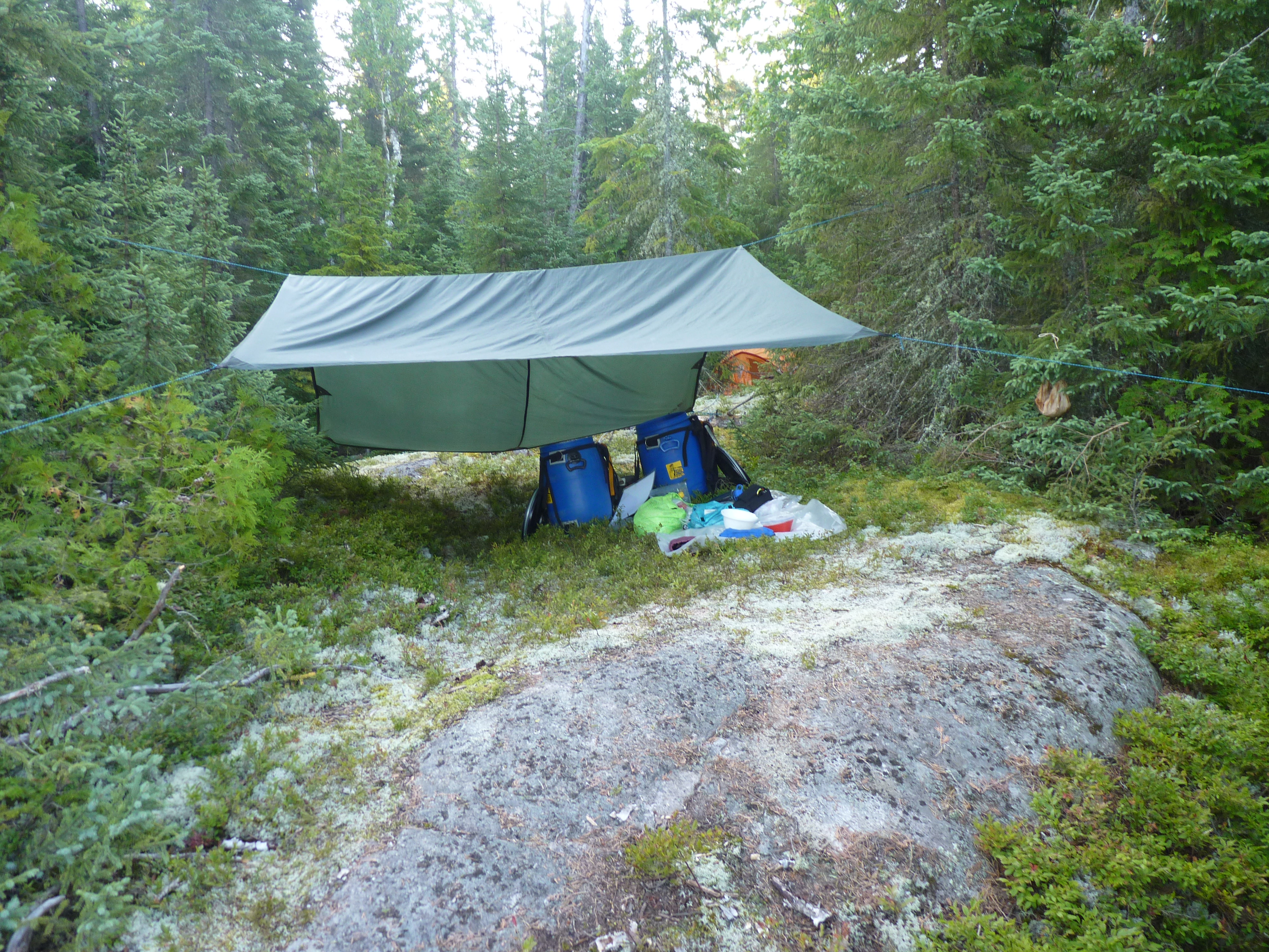
There's a fern bed here and a good place to setup our tarp so we decide it's home ..
Wenakoshi Campsite ...
The tent is a little too exposed for our liking so we'll try to find a better spot on our next visit.
We spend several hours over the next two days gathering up the trash that's here ... burning what we can and hiding the rest.
After a pot of coffee we decided to test our luck fishing ... my first six casts yielded 5 pike ... all of about the two to three pound variety.
We fished for about two hours and continued to haul in the pike.
Now we were loosing lures ... jigs mostly ... since we only had 8 pound line and no leaders available.
I rigged up some leaders out of some 20 pound line we had along ... we continued to loose lures ...
The biggest pike we landed was about 5 pounds.
All of this was just casting from shore off the rocky point in front of our site.
We gave up and came back after dinner ... just at dusk ... and continued to loose lures.
If you want some arm tiring action on medium sized pike this is the place for you ... and I guarantee that you'll have the place to yourself ... the fly-in guys from Rice Lake can't get here.
We did get up to Northpoint and spent three days there before returning to Rice and paddling back down the Rice River and out to Mallard Lake.
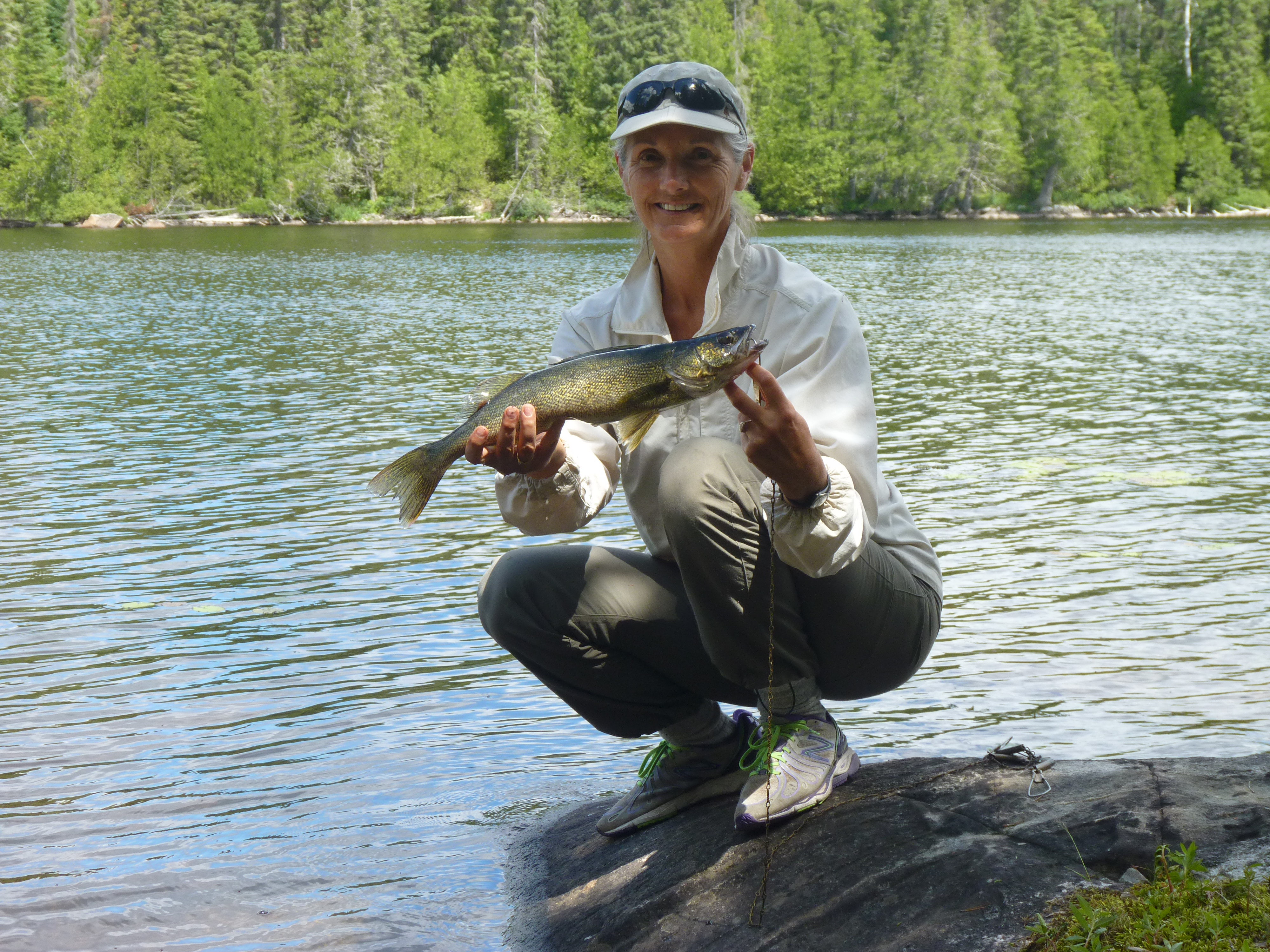
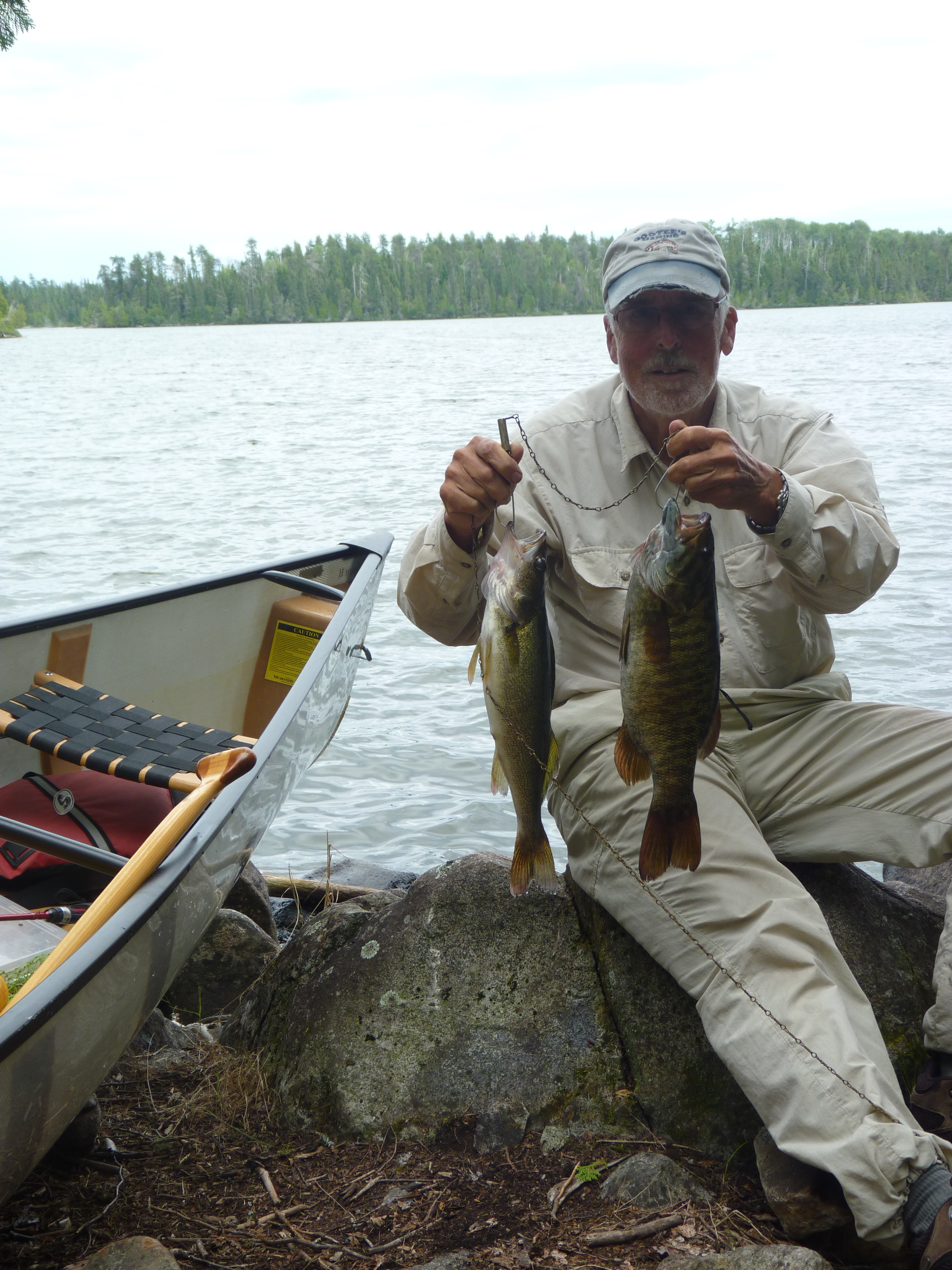
If you are a walleye fisherman here's evidence that the fishing in the area is pretty good.
Back on Rice Lake we caught these beauties ... a 24 and a 26 inch ... a quick picture and then we released them ...
A productive afternoon on Rice Lake ...
We could have had fish almost every night had we wanted to ... I think that there were only two days that we didn't catch any keepers.
On the way down the Rice River we made sure that all the portages were well marked at both ends ... The trip out from Rice to our truck on Mallard only took us six hours.
So come on folks ... whaddaya waitin' for?
2014 - July 10 to August 21
That's right, 42 days ... and we covered a lot of territory.
You may remember that the summer of 2014 was not the best ... as a matter of fact our 42 days saw mostly rainy days with wind from the north ... Hudson Bay lowland kind of systems ... cool and misty ... with the odd three day wind and rainy spell. Bugs were bad at the start and moderated to tolerable by the end. However, evening fishing was out of the question as we scampered to the tent just after sundown.
The trip was divided into three fourteen day segments ... the first was to take us from the bridge south through Opeepeesway Lake to Arbutus and on to Stoney, Potier and Windy.
The second leg would take us up through Mallard to Rush ... over to Rice and north to Northpoint and over to Wenakoshi.
Once on Wenakoshi we hoped to explore the area between Wenakoshi and Pebonishewi with the goal of marking and clearing a portage to cover the 1.6 km and allow us to get to Pebonishewi ... a lake that we originaly tried to reach from the south in the late 80's.
The final leg would see us traversing the Rice river again and portaging to Pebonishewi for a few days before returning to Rice and Rush as we made our way back to Mallard and out.
This was to be a more leisurely trip ... other than building a 1.6 km portage and getting to Pebonishewi ... we just wanted to visit some of our old haunts and explore some new territory with the plan to investigate some new places to camp and possibly build some new campsites.
Segment one: July 10 to 21.
After a 6am breakfast in Cartier at the Poplar Grove we arrived at the bridge around nine and were on the water a little after ten ... we camped on Opeepeesway Lake at the entrance to the northeast bay. This is a marshy section of the lake so the bugs were pretty bad ... even our exposed point didn't keep them at bay.
We awoke to a bright sky as the sun was about to rise. There was only a slight breeze so it was a good day to begin our trip to the east end of Opeepeesway Lake.
There are a dirth of decent campsites on the way ... all islands have been overused and/or trashed by spring fishermen ... so we wanted to see if we couldn't establish a site near the narrows at the entrance to the east end.
We woke to the constant drone of mosquitos under the fly but it had the promise of a sunny day.
It was indeed a nice day as we paddled south. We wanted to see if we could find or build a campsite at the narrows leading to the east end of the lake. The fishing around here is good but it's a long paddle from any established campsite on the east arm.
There are a couple of places to camp just inside the north arm that we stop to have a look at but this is not where we want to be so we put one of them on our list to stop at on the way back and continue on.
As we've reported previously, the islands on Opeepeesway have been overused by spring fishermen so we don't even stop to look at the couple we pass.
At the narrows there's nothing appealing but we still disembark to have a look.
Continuing along the south shore there's a rock shelf that slopes gently into the water so we check it out … it's not ideal … there's no good place to swim and the possible tent site is pretty small but we decide to make some improvements.
A couple of hours later and we're all set up. We decide to stay another day to really break the place in and to try the fishing. We did get out fishing with no great luck. Kathy caught a couple of keepers just off the front of the site but by now the wind was up from the north and it was turning colder so I found a sheltered spot to cook our hamburger helper dinner.
The next day was a continuation of the wind and showers … wind now from the northwest.
Some fishermen stopped by to see us … one guy reports that he's been fishing here for 40 years … his dad had a cabin on the lake and he continues to return whenever he can … they weren't having any luck.
Arbutus Lake is not far from here … only three portages … and I know there's a campsite on the mid-lake island … I'd camped here in the early 80's, moose hunted here in 1984 (at that time there was an abandoned house in the bay heading west … we setup our moose camp there) and we passed the island in 2008 … so we head there the next day.
The portages are in decent shape so the trip is fairly easy. The island is more bare than I remember but there's a built-in table and a firepit that I can rearrange to my liking.
Arbutus Campsite ...
We spend a day paddling around Arbutus and doing some unrewarding fishing … the old house is not only gone, but there's absolutely no trace of it … here's the guy that I was looking for in 1984.
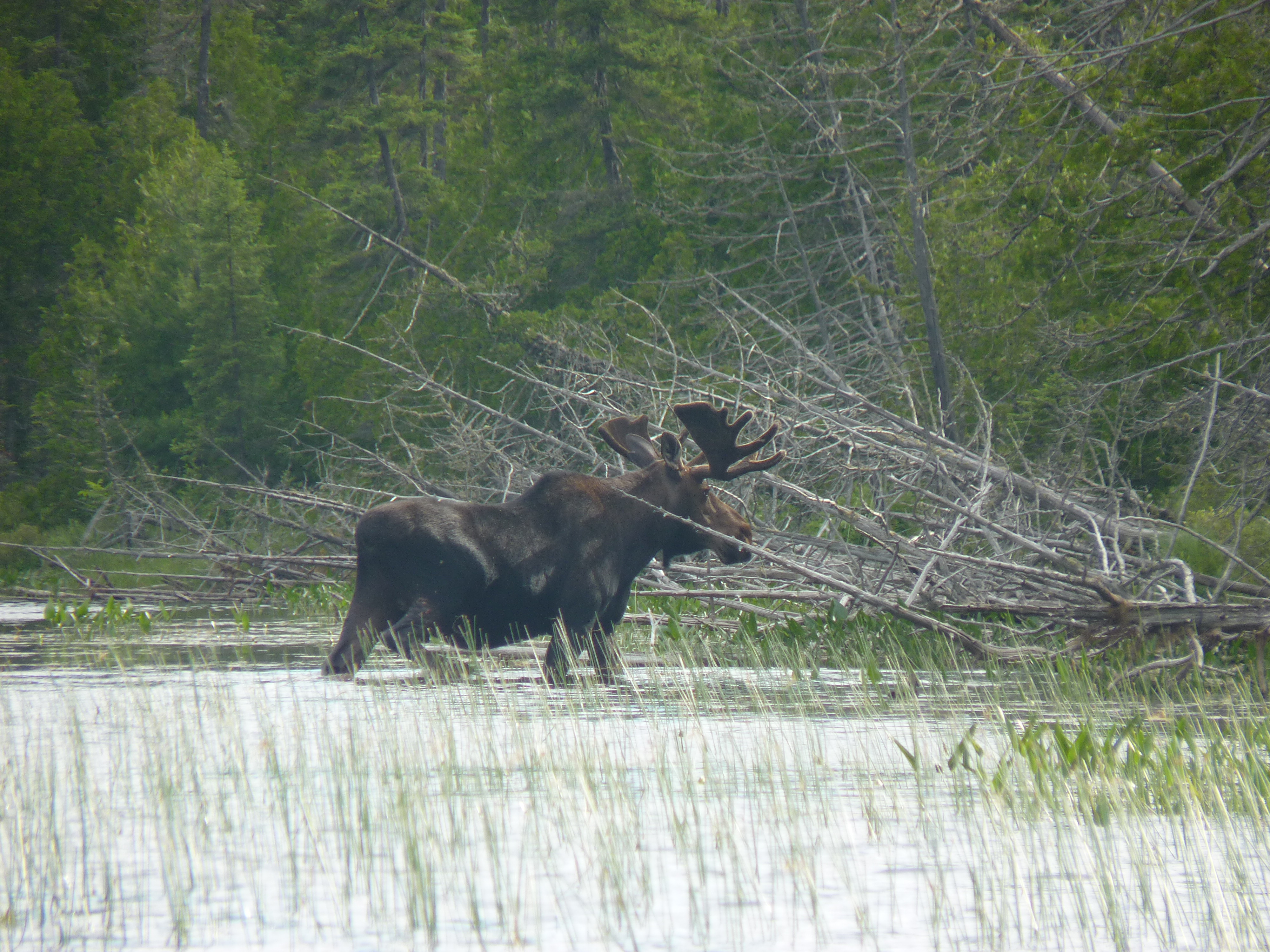
Nice bull moose ...
After a rainy and windy day we explore the southern end of the lake to find the old portage to Stony Lake. At the end of the lake there's a narrow rock filled section which will require portaging … even though the water is high there's not enough in this channel to float a canoe. The absence of a portage here is not a good sign but we continue on by carrying the canoe up the bank for the 70 meters or so to the next paddleable section.
Another 200 meters and there's a marker on the east shore so we pull over to check it out. A path leaves here along the river but soon veers left and heads up toward the road … we follow and sure enough it comes out at the road but leaves us 600 meters from the bridge at the outlet of Stony Lake.
We had hoped for a more direct path that would have put us within 100 meters of the bridge so we retrace our steps and make our way back to our island home.
It doesn't take much discussion to convince us that we don't want to follow the route we just explored … it was buggy and involved as much work as using the ATV path from Arbutus up to the road and then the 1000 meters to Stony. We decide to leave Stony and Potier to the end of our trip and drive in if we have time.
So it's back to Opeepeesway on a damp and dreary day punctuated by fog and showers.
The next day is clear and sunny but not very warm … Kathy does a wash and we dry and reorganize our gear.
Rainy, windy and cold are the earmarks of the next two days and since we have time we stay put.
On the third day they arose to a clearing sky and light breezes so it's off to the narrows toward the north end of Opeepeesway.
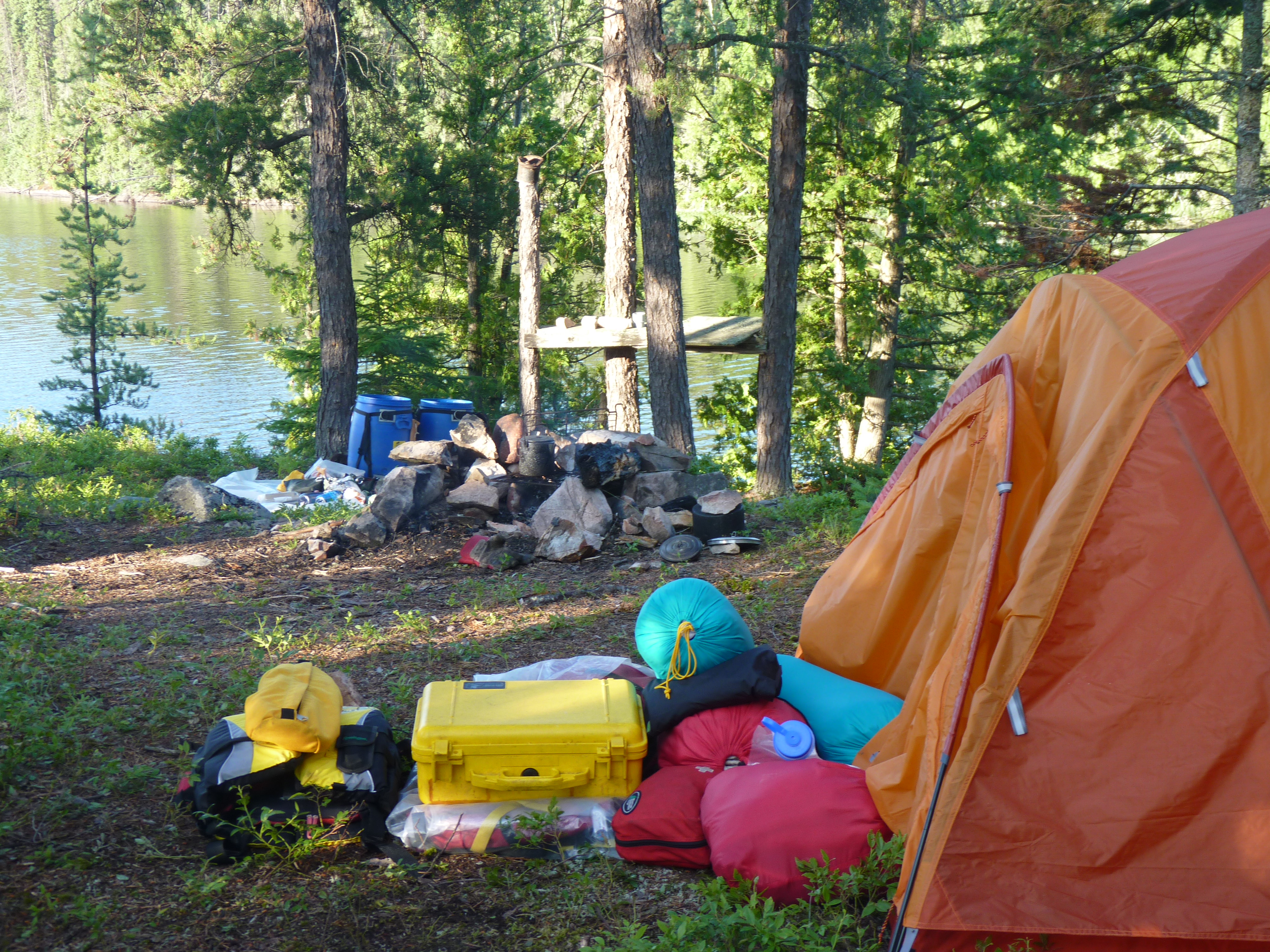
We arrive at the campsite we explored earlier and began the cleanup process … this is a low-lying area with a big marsh behind the site so we expect it to be buggy. The cleanup takes a while to round up the trash left by the spring fishermen but the stuff makes a good smudge fire and keeps the bugs at bay.
We go for a swim and a bath then try our luck fishing from both the shore and the canoe … only takers are pike … one good sized … we release it too.
A moose visits the marsh late in the day but we can't stay out to watch because we're getting eaten alive.
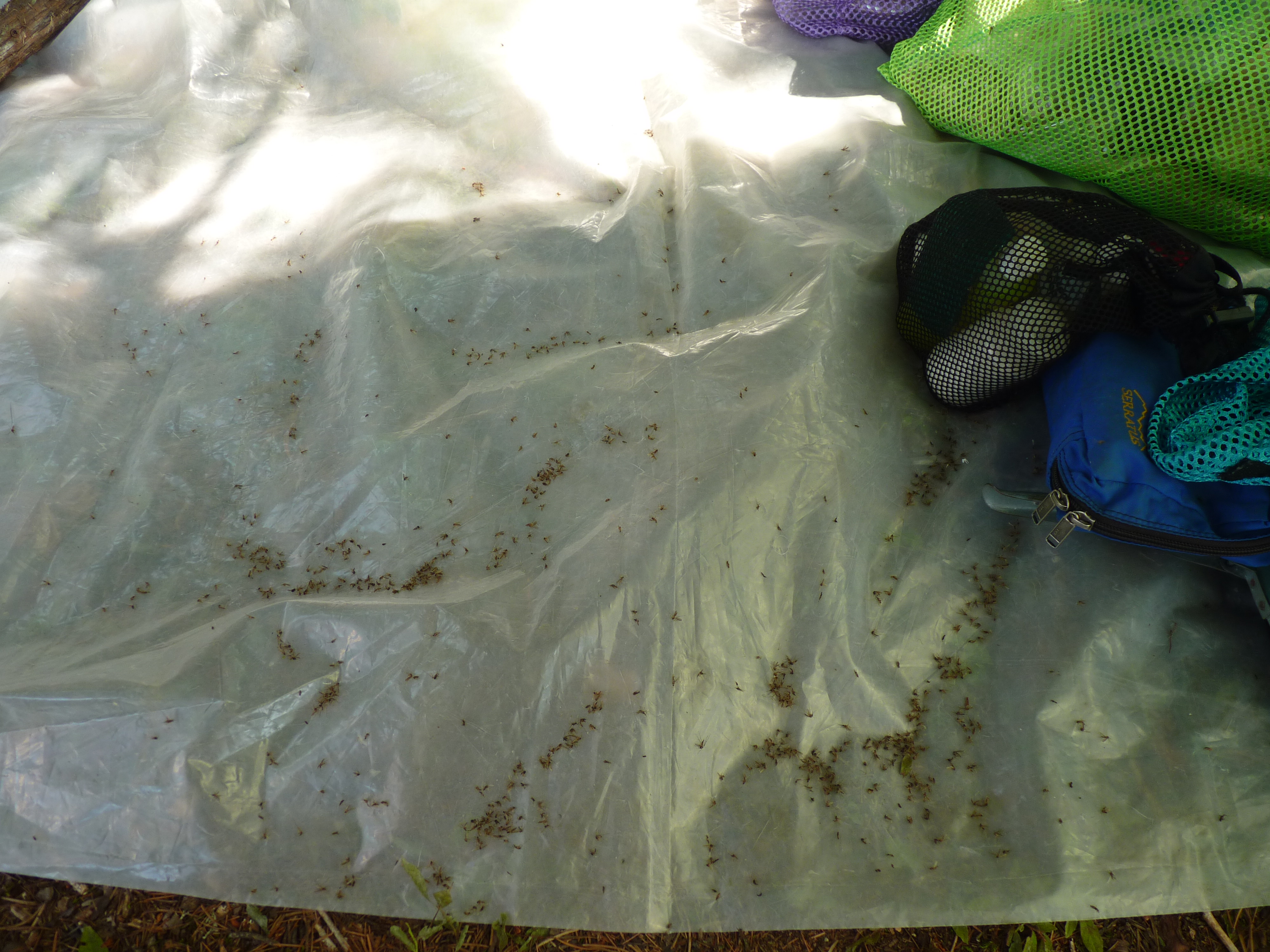
The bugs are really out overnight so I wait until after sunrise to get started … even a smoky fire does not seem to deter them … at one point I decide to stand my ground under the tarp and see if I can make a dent in the population … I'm killing several with every swat but after 15 minutes I'm getting nowhere … here's pictorial evidence of the bodies that fell on a sheet of plastic we keep under the tarp to place our foodstuff on.
15 minutes of swatting ...
We return to the bridge and drive over to Mallard Lake to conclude the first segment.
Segment two: July 22 to August 2.
The first day is a little hectic as we leave Opeepeesway ... load the truck ... drive over to Mallard Lake ... organize our supplies for this segment ... and paddle up through Mallard and Marion to Rush where we camp on a spot we've used since the late 80's.
After a rest day we paddle up the Rice River and after the five portages ... which were in good shape and which we cleared a little more since we'd be back this way ... and camp at the north end of Rice Lake.
Knowing that we've got a lot of work ahead of us we move to Wenakoshi and spend a day revamping the campsite and doing some fishing. This place is full of small pike but Kathy catches one that's eating size.
One decent pike ...
The next day dawns cloudy, warm and very humid. Looks like showers but we decide to try marking a trail over to Pebonishewi. We've consulted the map and decide that the shortest path will start down the lake behind the third island and go directly east for about 1.6km.
The landing spot is a little rough but we clear enough to get the canoe up to safety and start out ... clearing just enough to see our back path ... and installing trail marking tape at strategic intervals.
It doesn't take long for me to turn into a sweat soaked version of PigPen, including the cloud of bugs that hound me all the way across.
We finally emerge on the shore of Pebonishewi at a floating bog but it supports us all the way to waters edge.
We made the mistake of not bringing any water with us so we had to retrace our path ... and that took another hour.
By the time we got back to the canoe I was exhausted ... I'd had it with the humid conditions and the bugs.
When we got back to the campsite I told Kathy that there's no way I'm going to clear that portage and carry our stuff over to Pebonishewi only to spend a few days there and come back. Would I try it again in the future? I don't know ... but I do know that I'm not doing it now.
This puts a cloud over our next few days since we've got to rethink our schedule and get our minds around the fact that we'll not be getting to Pebonishewi anytime soon as well as the fact that we wanted to stay out for 42 days.
We spent the next day at our campsite getting rehydrated and considering our options. We still had eight days left in this segment before our planned trip back to Mallard Lake for resupply.
So its off to Northpoint to lick my wounds and spend a couple of days relaxing, swimming and fishing. The nice thing about Northpoint at this time of the year is that Ivanhoe Air does not operate its camp here. They only run it during May and June so we're completely alone here ... and the fishing was good.
Northpoint walleye ...
Our plan now is to execute our resupply and return to Rice Lake where we'll explore the southeast portion of the lake and establish at least one good campsite for future visits so its down to Rice north for a couple of days and out to Mallard for our resupply.
The resupply day is a long one as we travel down the Rice River and across the five portages and then tackle the marshy areas down through Marion to get to Mallard. Once on Mallard sort out the food and gear we'll need for the next segment, reload our barrels and paddle back north to Rush Lake.
Segment three: August 3 to 18
So we spend a couple of days on Rush ... and it was worth it ... weather was better and the fishing was good. When I first encountered Rush Lake in 1976 it was loaded with good sized pike but over the years the walleye have taken over the lake so that they are now the predominant species.
Rush Lake walleye ...
I'm getting tired of the Rice River and its five portages but at least we're keeping it open and its only about six hours from Rush to our spot on Rice north.
A day of rest and we head south and through the narrows to the east ... we're headed for a spot that I remember from our trip here in the late 90's ... a shelf all the way on the east side that I thought at the time would make a good campsite.
It doesn't look quite as I remember but after a little consideration we decide to setup here. The site slopes up away from the lake then dips down so we place the tent just over the rise and the tarp between it and the water. The fireplace goes down near the water on some solid rock.
Rice east campsite ...
There's a decent landing place, we can easily clear an area to store the canoe and the fishing is good by just casting from shore here.
The only drawback is that this site is at the extreme east side of the lake so it does not get morning sun and the prevailing winds blow directly on shore ... the afternoon sun beats full bore here so after a couple of really hot days we decide to move to a more protected place that we found on a nearby island.
Rice island campsite ...
The island provides a very secluded tent site and we soon clear a couple of paths to some rock outcrops where we can take our morning coffee, swim and fish. We get a couple of calm days that we take advantage of to explore the long bays extending to the south without finding and possible campsites that would surpass what we've got.
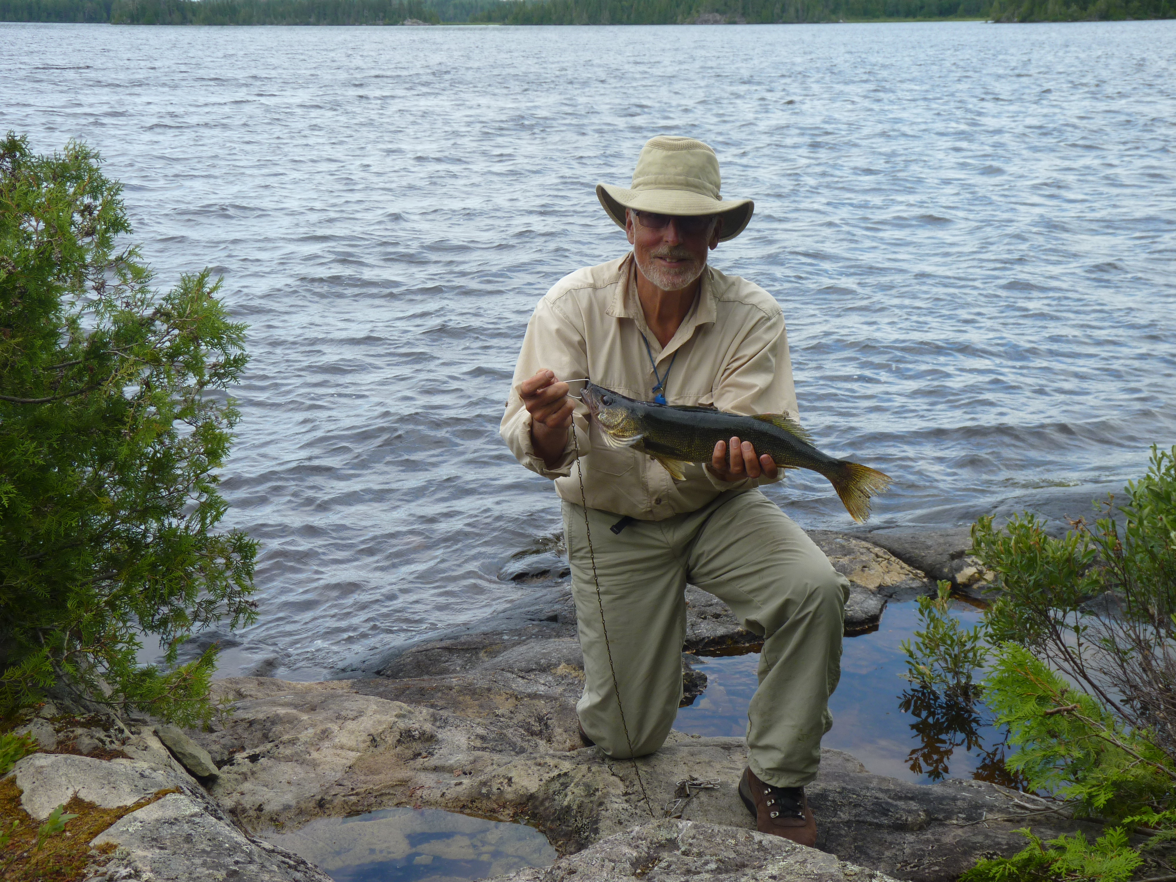
A short fishing excursion back toward our previous spot yields a couple of walleye ... we kept this one for dinner.
Walleye dinner ...
Time is gettingshort so taking advantage of a calm morning we start for the north end of Rice Lake ... passing the islands in the center of the lake we stop and look at a couple for potential camping spots ... there are some possibilities but the island that the fly-in guys use for shore lunches is a glorified latrine.
A one night stay on Rice north followed by two days on Rush and we're almost at the end of our trip.
We've got enough food left for a couple of days so we decide that on the way out we'll take the trip up the New Arbutus Road to Stoney Lake and paddle over to one of our favorite spots on Potier Lake.
The paddle into Potier was on a sunny afternoon so we soon had the site set up and spent a nice late afternoon swimming and sitting on the rocks drinking coffee.
We awoke to a very overcast and foggy morning that soon turned into drizzle.
This is not how we wanted to spend our last two days so as soon as we got a break in the rain we packed up and did the two hour paddle and portage back to the truck.
As the truck loading was completing the rain came back and continued with us until we were south of Parry Sound.
Discussion around how to get to Pebonishewi filled most of the trip home. Now that we'd actually seen it there's got to be a way that we can try those waters ... would we have to fly in?
The easiest route if we decide to resupply at our truck is to park at Mallard and go up to Rush and over to Rice then up to Wenakoshi ... that's three days to get in. Then we have to resupply which means retracing to Rush and Mallard before returning to Wenakoshi ... that's another four days. Finally the return trip from Pebonishewi will take four days. That's at least 10 days of back and forth paddling.
If we flew in to Rice we could be on Wenakoshi that same day ... if we had supplies dropped on Pebonishewi we'd waste no time with a resupply run ... and if we flew out from Pebonishewi we'd save another four days. So what's a saving of 10 days worth?
2015 - July 29 to August 27
Once the spring was upon us we began to plan for 2015 ... several calls to fly in services and we were sure that we wanted to use Ivanhoe air.
Ivanhoe has camps on all the major lakes in the area ... everyone we'd met on the lakes had nothing but good things to say about their service ... and George was an easy guy to talk with.
We arranged to get flown in to Rice Lake on July 29 ... a Wednesday since that's the day they run check flights to the camps in that area ... our resupply would get to Pebonishewi on August 12 ... and we'd fly out from Pebonishewi on August 27.
All we had to do was build a portage to cover the 1.6km from Wenakoshi to Pebonishewi and then slug our gear across.
I'd be 75 this year so this might be a challenge ... we plan four days to build the portage and then a rest day before the carry.
So on July 28 we make the drive from Hamilton to Folyete ... to avoid any traffic we leave home at midnight. With stops at Parry Sound and Sudbury for coffee we're at the Pine Grove in Cartier for breakfast around 8. The people here know us now and we always get filled in with the local hotspots as we share our plans.
We detour to Timmins for lunch and are at Ivanhoe Lake by 3pm ... it's a brutally hot day so we check in with George and Jean ... we're to stay overnight in one of their units at the lodge before we fly out at 8:30 the next day.
We bought some lettuce and tomatos on the way so we have sandwiches and water for dinner after a nice swim in the lake to cool off.
Up at 6am ... coffee and granola ... get our gear down to the dock area and out on the dock to the plane ... Dave will be our pilot today ... we load up with our stuff and some supplies for the guys on Rice Lake ... take off at 9 and are on Rice north at 9:45.
We want to try to get to the south east end if possible ... but the wind is coming up from the south ... and its another scorching day.
We make it to mid-lake and pull up on picnic island for a rest while we sit in the shade ... the wind is really strong now so we decide to camp here for the night ... it's so hot that the fish aren't even biting ... but the swimming is good until a thunderstorm rolls in.
Good thing we planned lettuce and tomato sandwiches for the first few days because the heat and humidity are so high that we don't want to make a fire.
We're up early ... it's going to be another hot day ... two hours od paddling gets us to our intended site ... a shaded, protected spot. A little clearing and cleanup and it's home. the paths to the water on the other side of the island need cleaning up but we're soon swimming and fishing off the island. The heat does not relent so the rest of the day is spent swimming and air drying.
Another day at the south end and we make the paddle to the north end where we'll spend two days before going to Northpoint.
This is one of our favorite spots ... we've been camping here since the early 90's ... swimming is good and fishing in the vicinity is usually productive.
2016 - July 27 to August 24
As you may recall, we’ve been traveling the waters of Sakatawi and attempting to both improve the portages and convince some of you to use this forgotten area since 2008.
2016 was planned to be an easy year where we would retrace the path we established in 2015 from Wenakoshi Lake to Pebonishewi Lake.
This year we’d clean up the 1.6km portage, remove some of the sharp turns and narrow spots and have an easier time carrying our gear over.
We wanted to spend a month on the water without having to loop back to our truck to pick up supplies so we again arranged with Ivanhoe Air to fly us into Rice Lake where we’d spend two weeks on Rice, Northpoint and Wenakoshi Lakes before working our way over to Pebonishewi for the last two weeks.
Ivanhoe Air is very busy on Friday, Saturday and Sunday as they get people out to one of their 27 outpost camps and bring back the previous guests.
Check and resupply flights are scheduled for Wednesday and Thursday so we piggybacked on the Wednesday flights to get into Rice, get our resupply delivered to Pebonishewi and to finally fly back from Pebonishewi.
On July 26th as we drove north on 144 in the area of the Sultan road we could see that there had been a winter system that had bent and toppled more than a few trees along the highway so we were wondering what lay ahead on our planned “easy cleanup” of that 1.6km portage.
After an overnight stay in one of Ivanhoe’s lodge units we were up and at the dock ready for our 8:30 flight … and a smooth one it was. We were on Rice north by 9:30 and since the wind was fairly calm we decided to paddle to a site on Rice south.
We stayed here for three days and did some exploring and the obligatory fishing … day 2 dinner shown here ..
Walleye dinner ...
Moving to our favorite site on Rice north was a bit of a disappointment … it had sustained a bit of wind damage and so required a two-hour cleanup before we could settle in … but we soon had the tent and tarp up and a pot of coffee brewing.
Tent's up ...
Coffee's on ...
Time to move to Northpoint … it’s only a three hour paddle up a lazy river and the beauty of Northpoint is that Ivanhoe does not operate that camp in July and August so we’re there by ourselves unless people from Rice decide to make the trip by motorboat which is not easy due to a couple of beaver dams.
Up a lazy river ...
I’ve said it before but it’s worth repeating … the fishing in this chain of lakes is very good.
Too much of a good thing … let’s move to Wenakoshi and face the task of clearing that portage and getting our stuff to Pebonishewi.
As expected the portage needed more than a little care … after six hours of walking and cutting we were back on Wenakoshi needing a swim and a bath.
The fishing is better in Pebonishewi so we tackled the portage the next day … it took us four hours … my 76 year old body can’t dance across portages the way it used to … but we made it in good spirits.
Only 800 meters to go ...
After a good long drink we paddled to our intended campsite only to find it completely blown in. This is a site that we spent several hours on last year … it provided both good swimming and fishing as well as a great vista … oh well.
We had another site further south so we headed there and fortunately it was unscathed.
Pebonishewi did not disappoint … we had built three campsites last year and visited each of them … we also constructed a new site to replace the one that was blown in.
Fishing here is still great …
This campsite survived ...
What are you waiting for? ...
We portaged south to Owatawetness for an exploratory trip … there were no places that called out to us for camping … the lake is shallow.
After exploring we decided to fish our way back north and were rewarded with a nice bass and walleye combo …. We brought these back to Pebonishewi for dinner.
Owatawetnes catch ...
We flew out on August 24th in great weather.
What do we have to do to get you to visit this area?
I’m coming to the end of my canoeing years … maybe a couple left yet … but this area needs to get used if the portages are to be kept open.
Here's a map of our trip with the portages marked ...
Rice, Northpoint, Wenakoshi, Pebonishewi ...
2018 - July 17 to August 30
This year we decided to try another approach to Rice Lake … we bought a canoe cart thinking that a trip to Little Rice and out to the road which gets to Rice would be a better option than the two 1000 meter portages from Little Rice or the 5 portages up the Rice river from Rush lake which total about 1300 meters.
Remember that I'm 78 this year … portaging isn't as easy anymore.
The overview.
This year's trip was 40 days and involved three legs.
The first was 19 days from the bridge over the Opeepeesway river to the east end of Opeepeesway lake then up through Little Rice and out to a gravel pit where we assemble the canoe cart and haul our gear the three kilometers to the trail leading down to Rice lake.
The ATV trail to Rice lake is about 600 meters and we remembered it as being pretty easy going for at least half of its length before it degraded into a boggy mess.
The second was 12 days on Kenogaming lake with a side trip to Kaneki lake.
We met the owners of Thunderstock Outfitters a couple of years ago at the Hamilton Outdoor Show and got their brochure. Kenogaming lake was easy to find on Google Earth and it looked like we could access the lake at its midpoint, so we thought we'd see what it was like.
The third was a trip back to Pebonishewi lake … not an easy place to get to but the fishing was great and we'd established some nice campsites.
The detail.
We began the first leg on July 17 by driving to the bridge over the Opeepeesway river and paddling south to enter the main part of Opeepeesway lake and camping for the night on one of our favorite spots. Unfortunately, this spot gets used by spring fishermen and they've manicured it with chainsaws over the years so that its getting too open for our liking.
Our jumping off point was to be the east end of Opeepeesway so we moved there and rested for the push to Rice.
The trip to Rice begins with a paddle, a lift over at a beaver dam, a 100 meter portage into Little Rice, and a 200 meter portage out to a gravel bank.
Here we assemble the canoe cart, load it up, and haul it 3 km to the ATV trail into Rice lake.

It's a really hot day … we get to the gravel bank at 11am … the fully loaded cart weighs about 250 pounds so its not that easy to move over the slight rises in the gravel road … then we arrive at the ATV trail and realize that its rutted up enough so that we'll have to carry the 600 meters into Rice lake.
The portion of the trail near Rice lake is still a mess … it hasn't been used recently but its still a mud hole requiring some careful routing and foot placement.
We completed our two carries and were on the lake at 2:30 pm.
There was no breeze, so we put our backs into it and paddled the two hours to get to our favorite campsite.
We go for a swim and purify a couple of liters of water to begin our rehydration as we setup camp.
Dinner is a couple of sandwiches and lots of water … no energy to build a fire and cook dinner.
Over the next fourteen days we changed campsites three times and at one point we ate fish six days in a row … only stopped because we realized that we had to carry our leftover food back to Opeepeesway.

The trip back to Opeepeesway was a little easier … a cooler day … still a slog up the ATV trail but a lighter load … slightly downhill with the canoe cart.
Here's me on the last portage of the day … the 100 meter out of Little Rice.

The second leg involved moving the truck back out to 144 and north to the road to Kenogaming lake … about 42 km north of Gogama.
We stopped in Gogama for lunch and explored the Gogama Unit road before heading north and into Kenogaming lake.
We arrived late so we had a sandwich and slept in the back of the truck.
Headed out on the lake at about 8 am and began to look for a place to camp … we found a spot that needed a bunch of clearing but was otherwise ideal. Three hours later we were ensconced in our new home … fireplace built … tarp up.


We had high hopes for this place … there was a nice place for swimming … the water got deep quickly just off the site … but fishing was a disappointment … only a couple of small walleye and pike.

We paddled around the lake on a calm day and located a nice spot to camp at the north end of the lake so we moved up there.
Scenery was great here again as was the swimming … but the fishing was still poor.

We had intended to move over to Kanecki lake but with the poor fishing we decided to cut our visit short.
By the way we had an observer … this young bear appeared on the opposite shore and watched us for a while before moving on.

The third leg started by an overnight stop at Peach lake … just south of the Sultan Road … to get our stuff dried out and do the resupply before the slog into Pebonishewi.
Pebonishewi was all we remembered … our old campsites were still in good shape (nobody comes here to camp) … fishing was still phenomenal … once again we ate fish until we realized how much we had to carry out.


The biggest smallmouth I ever caught ... he still swims there.

We came home with enough food to stock our first two weeks in 2019.
The happy couple drying out after the trip.

So come on guys ... we can't keep these routes open forever. We've been doing these routes since 2008 and its about time for someone else to pitch in.
